
Geospatial Visualization of Museum Institutions, Art Galleries and Private Collections in Bosnia and Herzegovina
Introduction
Bosnia and Herzegovina has a wide network of museums, galleries, and art collections that reflect its cultural and historical development. These institutions range from public museums to private and religious collections, forming a dispersed cultural landscape across the country.
These institutions are important for preserving and presenting cultural heritage. They document and safeguard historical and artistic materials and make them accessible to the public. They contribute to documenting, safeguarding, and presenting historical and artistic materials, making heritage accessible to wider audiences. In this way, they support both educational and cultural functions within society.
According to the International Council of Museums (ICOM), a museum is defined: “as a non-profit, permanent institution in the service of society that researches, collects, conserves, interprets, and exhibits tangible and intangible heritage.”[1] Museums are open to the public, accessible and inclusive, and they foster diversity and sustainability through their activities. In general, their functions include preservation, research, and presentation of cultural and historical materials. Through these roles, museums ensure that cultural heritage remains accessible and relevant to present and future generations.
A number of museum institutions in Bosnia and Herzegovina are designated as national monuments and are placed under state protection.[2] This designation indicates their institutional recognition within the national heritage framework.
Methodology
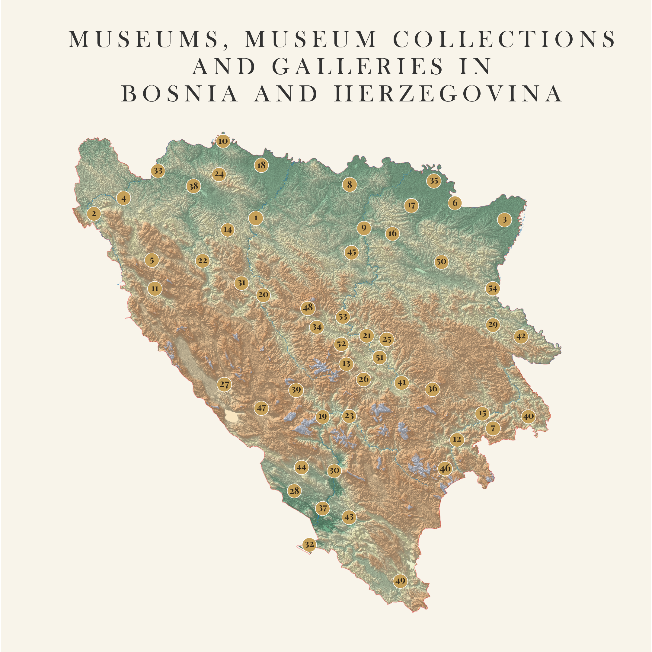
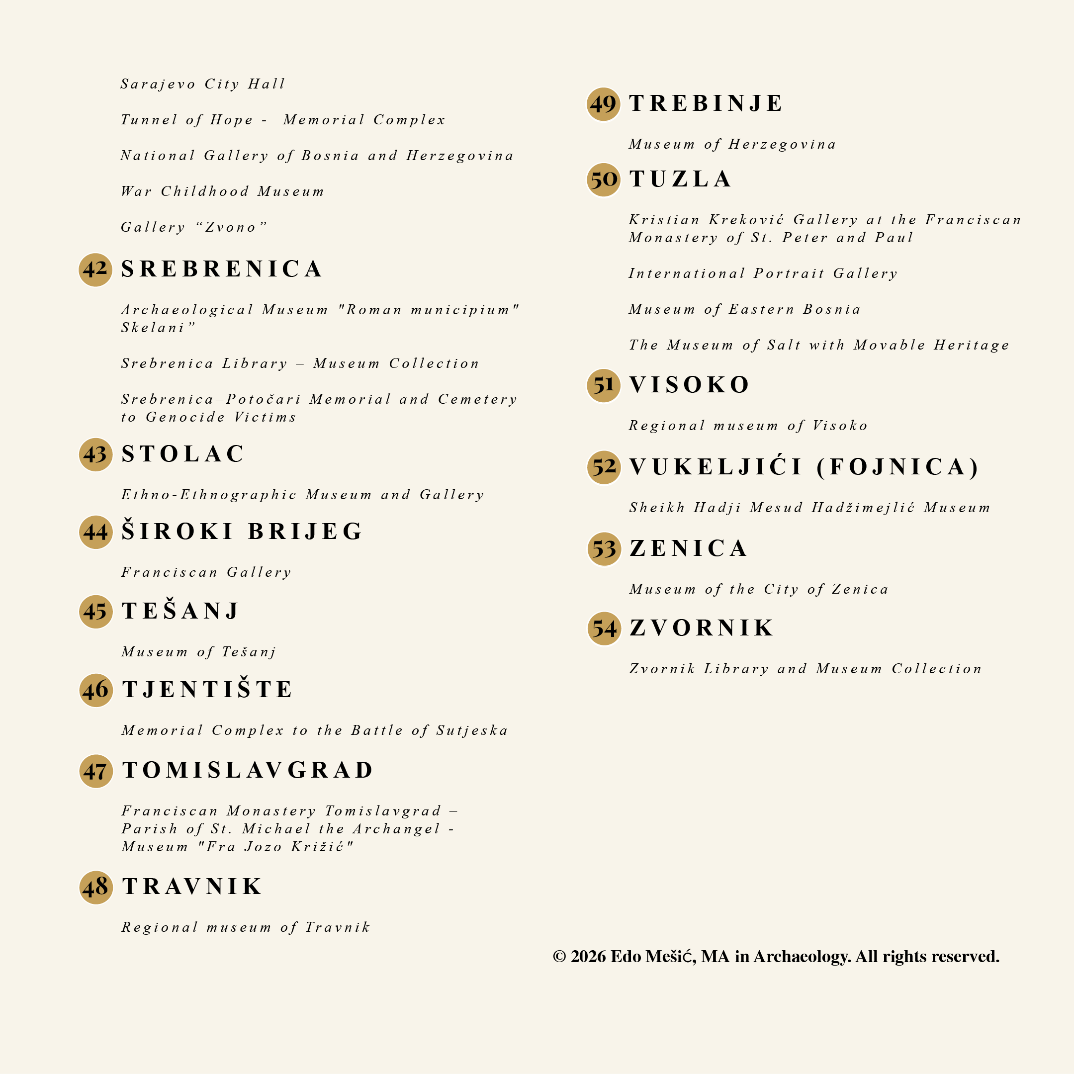
This study maps museum institutions, galleries, and collections in Bosnia and Herzegovina using GIS tools. The dataset includes institutions located in both urban and rural settlements and provides a spatial overview of their distribution.
The aim is to show where cultural institutions are located and how they are distributed across the country. Rather than functioning as a catalogue, the map enables analysis of spatial distribution patterns of cultural infrastructure across the territory of Bosnia and Herzegovina.
Geographic Information System (GIS) methods were used to organize and visualize spatial data. This allows for the representation of cultural institutions in relation to their geographic context.
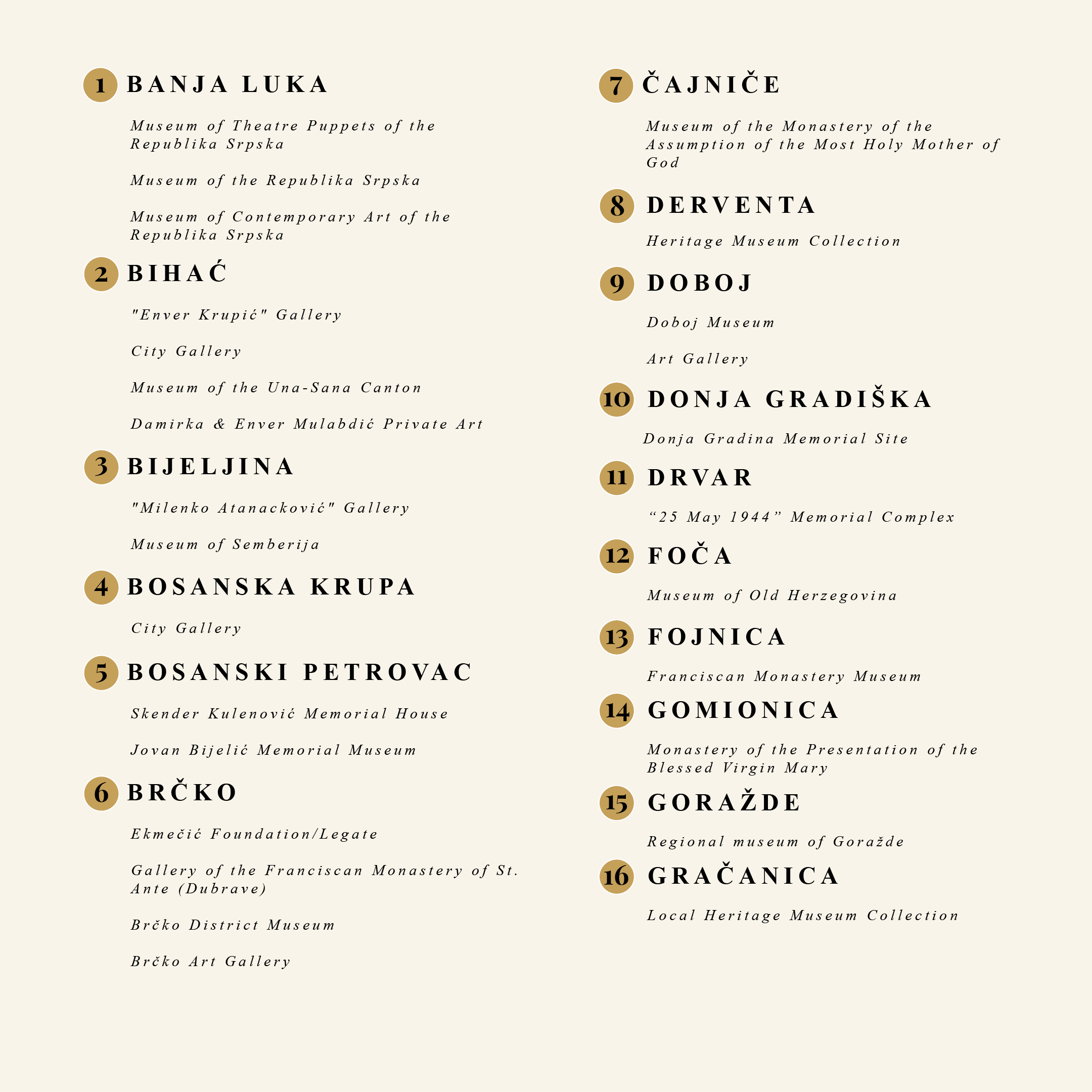
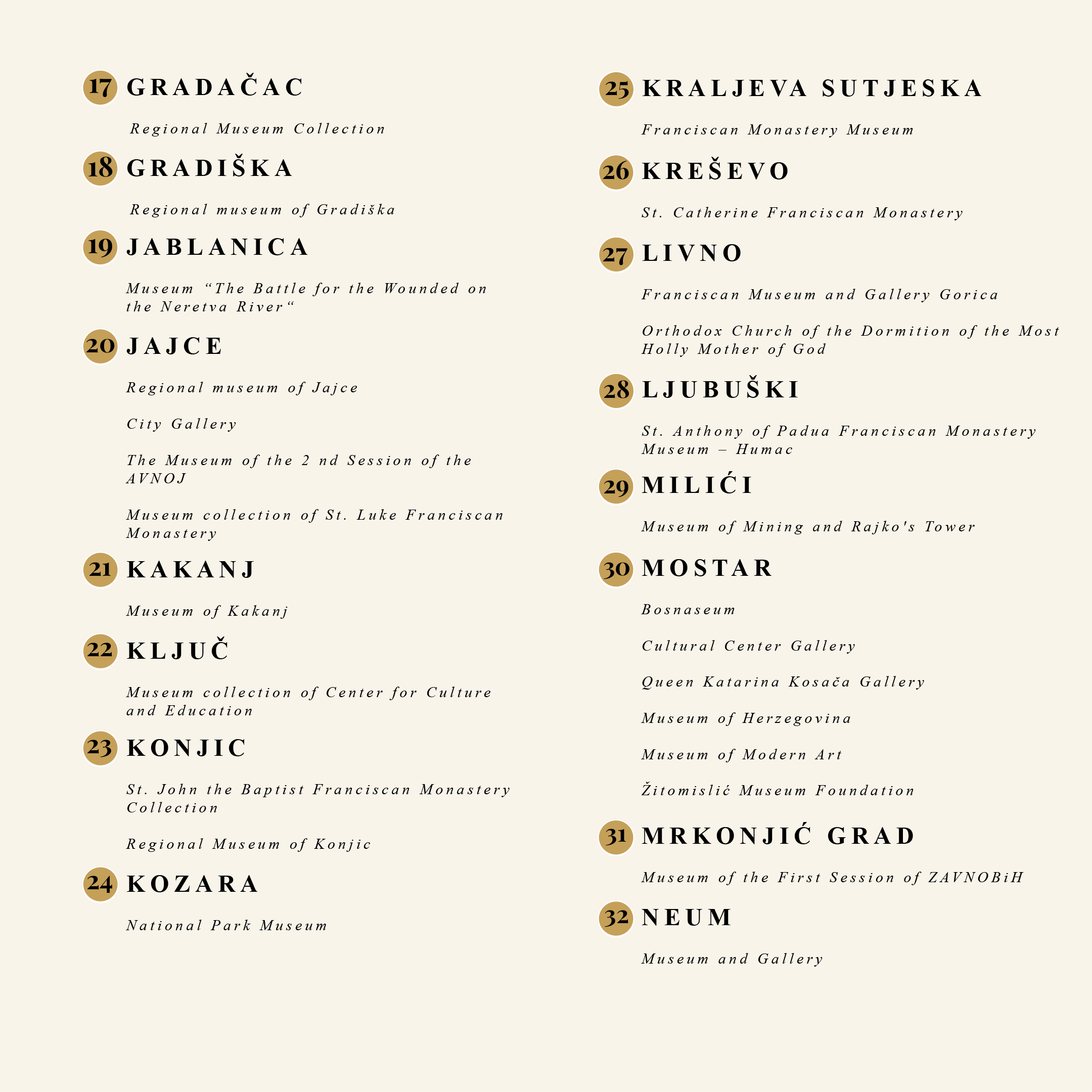
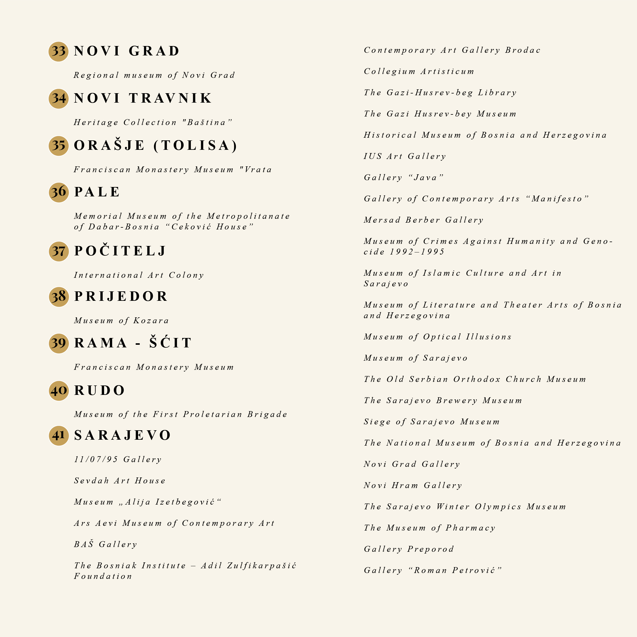
The primary dataset for institutional identification and classification was derived from Leka (2012), which provided a structured inventory of museums, galleries, and collections in Bosnia and Herzegovina.
Additional institutional verification and contextual classification were conducted using the International Council of Museums (ICOM) and the Commission to Preserve National Monuments of Bosnia and Herzegovina. These sources were used to confirm institutional status, definitions, and heritage designation.
Spatial data were organized within a GIS environment in order to enable structured visualization and spatial analysis of institutional distribution. Publicly available geographic reference data and institutional web resources were used to verify location accuracy and ensure consistency of the dataset.
Categories of Institutions
The dataset includes several categories of cultural institutions. Archaeological and historical museums form a major group in the dataset. They represent different historical periods and material cultures, often connected to specific regions or archaeological sites.
Art galleries constitute a separate category focused on the exhibition of visual arts. Their institutional role is primarily related to the presentation of artistic production. They are mainly located in larger urban centres.
Private collections represent a heterogeneous category with variation in thematic scope and institutional structure. These collections include artistic, historical, and religious materials. These collections vary in size and focus, ranging from small personal collections to institutionally organized archives.
Specialized institutions are also included in the dataset, such as pharmaceutical and mineralogical collections. In addition, a limited number of institutions are dedicated to individual archaeological sites.
A relief-based basemap was used to provide topographic context for the spatial distribution of institutions. The terrain visualization highlights the relationship between settlements, cultural infrastructure, and surrounding topographic features such as mountains and valleys.
Spatial Distribution
Museum institutions are concentrated in major cities such as Sarajevo, Banja Luka, Mostar, Tuzla, Zenica, and Bijeljina, while smaller settlements contain fewer institutions. Cities such as Sarajevo, Banja Luka, Mostar, Tuzla, Zenica, and Bijeljina contain multiple institutions, while smaller settlements typically contain fewer institutions. The observed distribution reflects variation in urban scale and administrative concentration of cultural infrastructure across the country.
Conclusion / Data Representation
This map provides a clear overview of the spatial distribution of cultural institutions in Bosnia and Herzegovina. By integrating institutional data into a GIS framework, the study provides a spatial representation of cultural infrastructure.
The dataset can serve as a basis for further spatial analysis and comparative studies of cultural heritage distribution.
References
Commission to Preserve National Monuments of Bosnia and Herzegovina. National Monuments List. https://kons.gov.ba/publication/read/nacionalni-spomenici-lista?lang=en.
International Council of Museums (ICOM). Museum definition. https://icom.museum/en/resources/standards-guidelines/museum-definition/.
Leka, A. (2012). Muzeji, zbirke i galerije u Bosni i Hercegovini. Sarajevo: ICOM / Dobra knjiga.
Notes
[1] International Council of Museums (ICOM), “Museum Definition,” accessed June 2, 2026, https://icom.museum/en/resources/standards-guidelines/museum-definition/.
[2]Commission to Preserve National Monuments of Bosnia and Herzegovina, “National Monuments List,” accessed June 2, 2026, https://kons.gov.ba/publication/read/nacionalni-spomenici-lista?lang=en.